
Project North Geomatics: Professional Bathymetric Surveys in Sunderland, Durham, Newcastle & Beyond
The CHCNAV Apache 4 Survey Boat.
Bathymetric Surveys in North East England:
From the River Wear in Sunderland to the Tyne in Newcastle, and from the Tees in Middlesbrough to the rugged coastlines of Northumberland, the waterways of North East England play a vital role in industry, transport, and the environment. To understand and protect these assets, specialist surveying is essential - and that’s where Project North Geomatics comes in.
Using advanced hydrographic technology such as the CHCNAV Apache 4 unmanned surface vessel (USV), we deliver highly accurate bathymetric surveys across the region. These surveys provide critical insight into the depth, shape, and condition of rivers, harbours, reservoirs, and coastal waters—helping local authorities, developers, and environmental organisations make informed decisions.
What is a Bathymetric Survey?

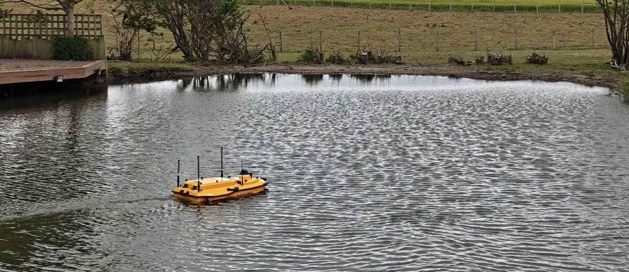
A recent topographic survey/ bathymetric survey of a pond in Durham.
A bathymetric survey is the underwater equivalent of topographic mapping. Instead of mapping hills and valleys on land, it maps the contours of the seabed, riverbeds, and lakebeds. Using sonar, GPS, and cutting-edge USVs like our CHCNAV Apache 4, we capture detailed data that reveals the true picture beneath the water’s surface.
This data is then processed into accurate survey deliverables, supporting everything from safe navigation to environmental management.
Why Bathymetric Surveys Matter in the North East
1. Safe Navigation for Ports and Harbours
North East England is home to busy maritime hubs including Port of Sunderland, Port of Tyne, and Teesport. Bathymetric surveys ensure channels are clear, hazards are identified, and navigation remains safe for commercial shipping, fishing fleets, and leisure craft alike.
2. Infrastructure and Development
Major civil engineering and marine construction projects in Durham, Newcastle, and beyond rely on accurate seabed mapping. Whether it’s planning bridge foundations, offshore wind farms, or flood defence structures, our surveys provide the precision data needed to design and build with confidence.
3. Environmental Monitoring
From the conservation areas of the Northumberland coast to the River Wear and River Tees, understanding underwater environments is essential. Bathymetric surveys help track sediment changes, monitor erosion, and protect sensitive habitats - supporting both sustainability and biodiversity.
4. Flood Risk and Water Management
Inland waterways and reservoirs across County Durham and Tyne and Wear are constantly evolving. Our surveys support flood modelling, reservoir management, and dredging operations - helping local councils and water authorities keep communities safe.
5. Cutting-Edge Technology: CHCNAV Apache 4
At Project North Geomatics, we invest in the latest technology to deliver the highest quality results. The CHCNAV Apache 4 USV allows us to collect bathymetric data safely and efficiently, even in shallow or difficult-to-access waters. Its precision and reliability set a new standard in hydrographic surveying.
Why Choose Project North Geomatics?
Based in the North East, Project North Geomatics is trusted by clients across Sunderland, Durham, Newcastle, Northumberland, and Middlesbrough. We combine local knowledge with world-class technology to deliver bathymetric surveys that are accurate, cost-effective, and tailored to your project.
Whether you’re a port operator, a civil engineering firm, an environmental agency, or a local authority, we provide the data you need to plan with confidence and manage waterways responsibly.
Shaping the Future of North East Waterways
The rivers, lakes, and coastal waters of North East England are constantly changing. By investing in professional bathymetric surveys, organisations can ensure safety, sustainability, and smarter decision-making for years to come.

Bathymetric Survey in action.
Get in Touch
Looking for a bathymetric survey in Sunderland, Durham, Newcastle, Northumberland, or Middlesbrough?
Contact Project North Geomatics today and see how our expertise and technology can support your project.