
Bathymetric Surveys

A bathymetric survey is the process of mapping the underwater topography of rivers, lakes, reservoirs, and coastal areas. Using sonar technology and GNSS positioning, it accurately measures water depths and the shape of the riverbed or seabed. This data is essential for flood modelling, dredging assessments, environmental studies, and infrastructure inspections.
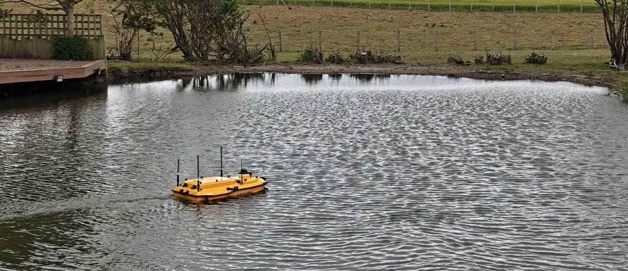
We offer cutting-edge bathymetric survey solutions using the CHCNAV Apache 4, a state-of-the-art autonomous surface vessel designed for high-accuracy underwater mapping in shallow and hard-to-reach water bodies. This fully integrated platform combines GNSS positioning, IMU, and dual-frequency echo sounding to deliver detailed, georeferenced bathymetric data safely and efficiently.
Bathymetric Surveys – Precise Mapping Below the Waterline
Our bathymetric survey services deliver accurate, high-resolution maps of underwater environments, enabling smarter decision-making for projects in rivers, lakes, ponds, and coastal areas. Using advanced sonar systems, GNSS positioning, and 3D data capture techniques, we help engineers, ecologists, and asset managers uncover the hidden terrain beneath the water's surface.
Compact, Capable & Cost-Efficient Survey Vessel
Our custom-built survey vessel is equipped with high-spec interferometric sonar and is ready to deploy with no need for cranes or heavy equipment. With a shallow draft and low profile, it can access tight, shallow watercourses and pass under low bridges with ease - cutting down mobilisation time and reducing costs.
What We Deliver
We generate high-density, georeferenced point cloud data both above and below the waterline, enabling full 3D visualisation of underwater structures and bed features. Our data is ideal for:
Flood risk modelling
Sediment and scour assessments
Infrastructure inspection (e.g., pipelines, outfalls)
River restoration design
Habitat and biodiversity mapping
Volume calculations for dredging and infill
Why Choose Us?
Precision technology: Capture underwater terrain in fine detail using 240° sonar coverage
Efficient access: No cranes needed - launch from riverbanks using our own ramp and winch system
Integrated deliverables: Combine sonar data with aerial LiDAR for a complete river corridor model
Cost-effective solutions: Ideal for locations where traditional surveys are too expensive or impractical


Equipment We Use:
We offer cutting-edge bathymetric survey solutions using the CHCNAV Apache 4, a state-of-the-art autonomous surface vessel designed for high-accuracy underwater mapping in shallow and hard-to-reach water bodies. This fully integrated platform combines GNSS positioning, IMU, and dual-frequency echo sounding to deliver detailed, georeferenced bathymetric data safely and efficiently.
Why We Use the Apache 4?
The CHCNAV Apache 4 is ideal for environments where traditional boat-based surveys are impractical or risky. Whether surveying narrow rivers, reservoirs, lagoons, or construction sites, the USV provides:
Autonomous operation: Remote-controlled or pre-programmed missions for safe access to challenging areas
High-resolution data: Integrated single or dual-beam echo sounders with centimetre-level GNSS accuracy
Shallow water capability: Lightweight, low-draft catamaran hull glides through areas inaccessible to manned vessels
Real-time monitoring: Live data transmission for immediate quality control and adaptive survey adjustments
Applications
Flood risk and hydraulic modelling
Dredging and volume calculations
Environmental impact assessments
Sediment and scour monitoring
Submerged infrastructure inspection
Habitat and aquatic ecology studies
Deliverables
We provide fully processed geospatial data outputs including:
Bathymetric contour maps in DWG format
3D point clouds and terrain models
Cross-sections and volume analysis
GIS-ready data formats and custom reports
We provide specialist bathymetric survey services across the North East of England, including Newcastle, Sunderland, Durham, and surrounding regions as well as the rest of the UK. Using the advanced CHCNAV Apache 4 USV, we deliver precise underwater mapping for rivers, reservoirs, and coastal sites - ideal for flood modelling, dredging, and infrastructure inspections. Whether you're working on a civil engineering project in the Tyne & Wear area or assessing watercourses in rural County Durham, our team combines local knowledge with cutting-edge technology to provide safe, efficient, and highly accurate survey data tailored to your needs.